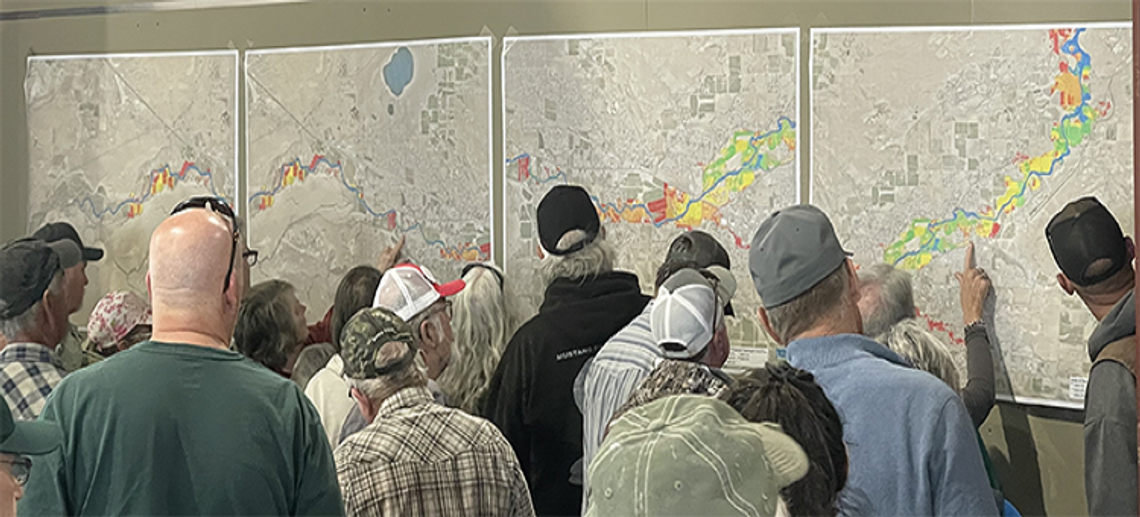
Local officials held a Townhall meeting on Thursday, April 13, at the Rafter 3C to provide an update on local high-water mitigation efforts.
Churchill County has developed predictive mapping that was presented and is now available on the county website under the “High Water ’23” tab. The mapping shows potential flows in the event that water fills Lahontan Reservoir and begins flowing over the top of the flashboards.
Currently, the Carson River below the dam is flowing at 1,000 cubic feet per second. Maps depict potential flows in different scenarios, including 2,000 cfs and 4,000 cfs.
“This information is all meant to be precautionary,” said County Manager Jim Barbee, “it is meant for you to prepare and is not inevitable. These predictions are at least a month out; we are talking the end of May, beginning of June.”
Local volunteer youth will work in coordination with the city/county sandbag crews to fill, deliver and set up bags for seniors/disabled living on the river on April 22. Those wanting this service should contact the Call Center at (775)867-5923 by April 19 to make arrangements.
There has also been established a High Water Call Center. The community can call 775-867-5923 or email [email protected]. Residents are encouraged to report any obstructions or issues in the river or area bridges or structures.
“If there is an emergency, of course, call 911, but please use the new number or the email for issues that are not emergencies,” said Barbee.
During the meeting, Caleb Cage, a consultant for the county on emergency management issues, reported on the preventative actions taken by community officials. Jack Worsley, area manager of the Bureau of Reclamation in Carson City, also delivered the snowpack forecast.
Construction is underway on a second weir on the V-line canal, west of town, to divert excess water around the community and into the Carson Lake Pasture and Stillwater wetlands. There is also ongoing construction to build a berm on the northeast side of Carson Lake to contain water runoff from the lake. “TCID (Truckee-Carson Irrigation District) and the BOR continue to monitor and control the flows,” said Cage.
Worsley said the snowpack is currently at 1.1 million acre-feet, higher than the 2017 flood event. He said the snow melt might result in 880,000 af of water in and through Lahontan, which can hold at maximum capacity just over 300,000 af. “The biggest flows are expected at the end of May,” he said. “We have inspected all the dams, and all the facilities are in great shape. Containment from the dam is not a problem, how it comes in is the unknown.”
Currently, there is 86,000 af in Lahontan, giving 220,000 af of space in the reservoir.
Barbee said the Rafter 3C facility could be used in a worst-case scenario, with the 75,000-square-foot building equipped with backup power, RV parking, and plenty of room for livestock if necessary. He encouraged community members to look at their situation and consult their insurance providers.
“We are asking you to stay informed, stay prepared, and stay engaged,” he said.


Comment
Comments