During the board meeting Tuesday, April 4 TCID officials commended the work being done to prevent community flooding. “People are working tremendous hours, they are not sleeping well right now, we are really lucky to have the people we have,” said Eric Olsen, board president. The flood operations team meets every Thursday.
General Manager Ben Shawcroft echoed Olsen’s comments saying this year is different from the 2017 flood. “There is a lot going on with flood operations, these guys are monitoring constantly, and we are very busy,” he said. “In addition to the flood issues, district staff is also ramping up deliveries, trying to clean out delivery structures.”
Shawcroft said that there needs to be a sense of urgency about the flooding situation and after the town hall meeting held on March 23, the call center went from one call a day to over 25 each day, showing that people are becoming more aware.
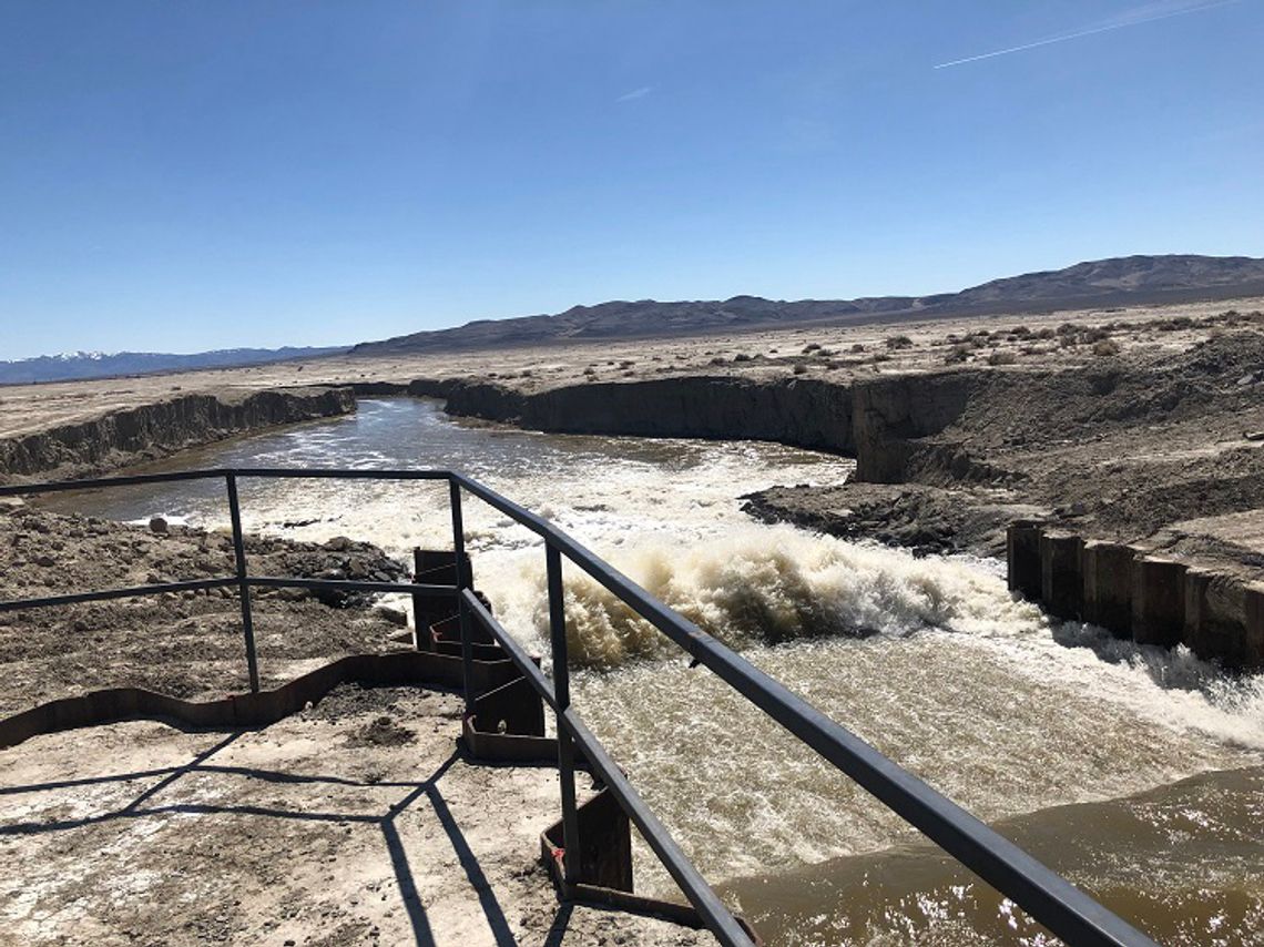
He also reported that the plans for the second weir were received this week and work on the Big Berm in the Carson Lake Pasture is underway, creating an eight-mile-long berm that is six feet high to allow for increased water capacity in the Carson Lake. The second weir will allow more water to flow through the system as Lahontan continues to fill due to the historic amount of snowpack still in the mountains.
Kelly Herwick, watermaster, reported that on Tuesday, April 4 the gauge at Ft. Churchill was measuring 1,110 cubic feet per second flowing into the Lahontan Reservoir, and the lake level in the reservoir was at 109,457 acre-feet of water. There were at that time, 2,500 cfs being released from the reservoir into the Carson River below the dam.
The reservoir, with the use of 20-inch flashboards, will hold 308,000 a.f. of water.
During the Churchill County Commission meeting on Thursday, April 6, Joe Sanford, Civil Deputy District Attorney, reported that the new forecasting numbers from April 1 were expected to be released at the weekly flood meeting. Estimates using LiDAR technology area have put the amount of water still in the mountains at nearly 1.1 million a.f., with a range of efficiencies dictating the amount of run-off, ranging from twice to three times the capacity of Lahontan.
For the safety of citizens and construction personnel, community officials have closed Casey Road until further notice at the 26-foot drop, near the end of the pavement at the far west of the road, as the second weir is constructed. Local road closures due to High Water Operations include Casey Road at the 26-foot drop and Macari Lane.
In normal water years, the Newlands Project system provides irrigation water to local farms through a network of canals, ditches, drains, and small regulating reservoirs. In high water years, managing the system to prevent area flooding becomes a work of art, as evidenced by the careful management during the 2017 flood, as flows through the irrigation system are carefully choreographed through meticulous management and timing of water flows that protect the community and the project facilities.
A local High-Water Call Center has been established and is monitored weekdays from 8 a.m. to 5 p.m. at (775) 867-5923 for non-emergency inquiries regarding high water such as sandbag availability, Lahontan Reservoir levels, weather forecasts, etc.
All current high-water information is available on the Churchill County website: www.churchillcountynv.gov (click on the blue tab at top of the page), City of Fallon’s website: www.fallonnevada.gov (click on the red ribbon near the top of the page) and TCID’s web page at: www.tcid.org and on Churchill County’s Facebook and Twitter accounts.


Comment
Comments