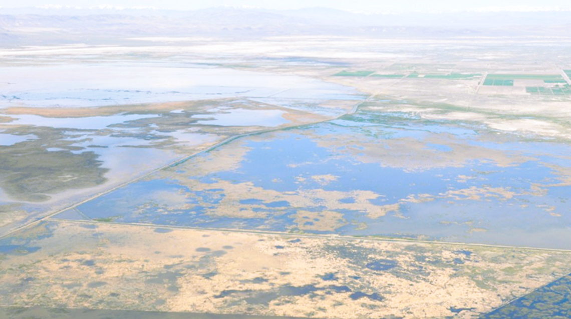
When people think of Nevada, an overabundance of water is generally not what comes to mind, even in the Sierras. But that is exactly what is happening right now. So much water Churchill County Commissioners approved the construction of a second weir to help divert the rapidly rising snowmelt feeding the Carson River, which ultimately flows through the Lahonton Reservoir and throughout the valley.
The first weir, constructed in 2017, formed a break in the V-Line canal and was created to relieve high water flows and release surplus water into the desert as floods threatened many homes and structures along the banks of the Carson River and in its immediate vicinity. The second weir, bearing a hefty price tag of $5.5 million, is being dug in anticipation of higher water flows that could far exceed 2017. The county is also working to clear limbs and debris from the Big Dig canal to ensure that water flow is as unobstructed as possible.
After a March 16 aerial tour of areas impacted by rain, snowmelt, and high-water flows, Governor Joe Lombardo amended his March 10 declaration for a State of Emergency. Initially, Douglas, Lyon, and Churchill were named in that order. However, after Lombardo’s tour, Carson City, Esmeralda, Elko, Eureka, Humboldt, Lincoln, Mineral, Nye, Storey, White Pine, and Washoe counties, along with the Walker River Paiute Tribe, Yerington Paiute Tribe, and the Yomba Shoshone Tribe were also deemed as impacted by ongoing water and weather events. The amendment enables these areas to receive state and federal assistance to mitigate potential flood damage and repair infrastructure, as flooding is anticipated throughout the region.
The US Geological Survey (USGS) reports that flooding is more common in Nevada’s Great Basin than expected. Most floods in the Carson River Basin, which spans about 4,000 square miles, have resulted from rain-on-snow events and moisture-laden air from the Pacific Ocean in the form of Atmospheric Rivers (See bit.ly/3M2fCS9 for more information). According to the USGS, such events often cause widespread flooding and subsequent damage throughout the basin. As the Carson River is not a deeply incised channel as is found in larger rivers across the country, rising water levels flow outward to the adjacent flood plains. The Carson River can usually accommodate the snowmelt as it gradually feeds into the river. However, this year, record snowpack and warm spring rains have drastically increased the volume and speed of snowmelt, which can overwhelm the flood plain, which becomes a discharge surface.
Churchill County and the City of Fallon urge residents to be aware of the rapidly changing water situation and prepare for potential high-water events. More rainfall, snow, and severe weather conditions are expected, increasing the risk of flood in the area. The National Weather Service issued a flood advisory for a dam floodgate release, now in effect until 5 p.m. on April 10. The advisory noted that potential prolonged minor flooding and high flows along the Carson River are anticipated due to the dam release. Residents of low-lying areas, including Bafford Lane, should take extra care to safeguard against flooding. Vehicles are advised to turn around when faced with flooded roads, as most flood deaths occur in vehicles.
From Churchill County: The High Water Call Center continues to provide non-emergency resources for citizens seeking information about potential flooding. (Open M-F 8 a.m. to 5 p.m.). Call Center Phone: 775-867-5923.
Sandbags are available for pick-up at 485 Miner’s Road (M-F 10 a.m. to 12 p.m., 12:30 p.m. to 2 p.m., and on weekends from 9 a.m. to 2 p.m.)
The hour-long video of the March 23 high-water town hall is available at: https://www.youtube.com/@churchillcounty/videos and a written summary of the town hall is available on the county’s website at: https://www.churchillcountynv.gov/CivicAlerts.aspx?AID=544


Comment
Comments