.jpg)
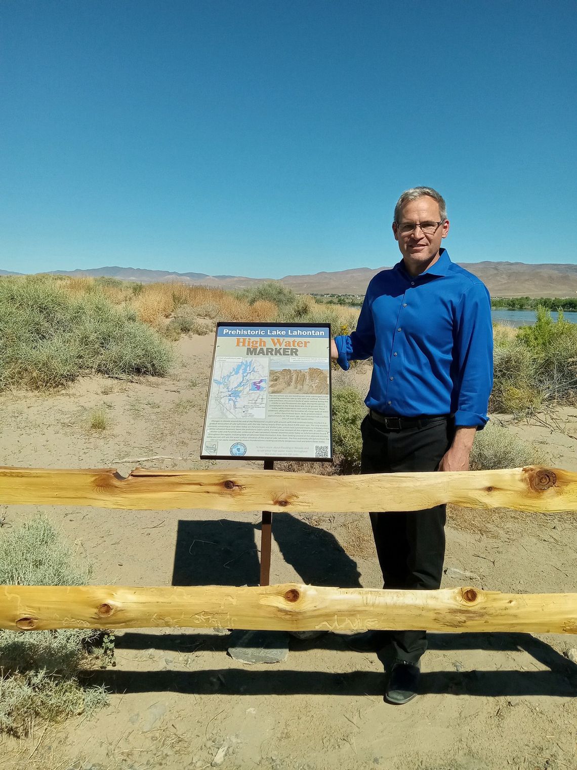
Silver Springs Stage Middle School students gathered with several state agencies on June 5 at Fisherman’s Point on the Silver Springs side of Lahontan Reservoir to celebrate unveiling the lake’s new high-water mark signage.
The new sign is part of the Nevada Silver Jackets’ Nevada Comprehensive High Water Mark Campaign, designed to raise awareness about historic flooding in Nevada, promote the importance of maintaining natural floodplains and water management systems, and prepare for future flood events.
"We're thrilled to introduce this new educational feature at Lahontan State Recreation Area. The sign offers valuable information about the natural and managed hydrology of the area,” said Park Supervisor Ashlee Goeddel, who also hopes to encourage visitors to come see the sign and take advantage of the diverse recreational opportunities available at the park.
As a marker, the sign documents the history of flooding in the area and the surrounding region, dating back to the Pleistocene Lake Lahontan. According to the Nevada Department of Conservation and Natural Resources (DCNR), the marker serves as an educational tool, providing insights into the historical context, environmental conditions, and water management practices that led to the construction of Lahontan Reservoir.
The presentation began with a bit of background on Lahontan Reservoir and information on the importance of water level education, as our area is designated as a flood zone.
Nevada State Engineer Adam Sullivan explained why this water mark is so important. According to Sullivan, Lake Lahontan is 100 feet lower now than 12,000 years ago. Documenting this is important, said Sullivan, because we live in a flood zone. “The high-water mark sign not only marks a significant historical event but also serves as a reminder of the importance of water conservation and management in Nevada,” said Sullivan.
Unveiling the high-water mark display, Sullivan appreciated the many entities that made the event possible. “I am thankful for the collaboration and partnership between these diverse state, local, and federal agencies to help us all understand why floodplains and flood preparedness are so critical to Nevadans.”
Booths were set up by the River Wranglers, U.S. Army Corps of Engineers, Carson Water Subconservancy District, Nevada Department of Wildlife, and the Nevada Bureau of Geology, UNR, allowing students to learn and explore. Each booth offered activities and information to educate students about the lake and its history. Different topics included floodplains, watersheds, rocks and area geology, fish and wildlife, and more. Students also learned about the various partner agencies, potential future career opportunities, and what steps to take if they are interested.
Certificates were given to project partners and to all 100+ Silver Springs students who participated in the event. Students also received goodies to take home from each booth commemorating the event. Other partners included the Nevada Silver Jackets, Nevada Division of Water Resources, Nevada Division of State Parks, Federal Emergency Management Agency, Lyon County, Nevada Bureau of Mines and Geology, and UNR.
For more information about the park, please visit parks.nv.gov/lahontan. For more information about the Nevada Floods program, visit nevadafloods.org.


Comment
Comments