

12/22/2023 Update: The U.S. Geological Survey is continuing Earth MRI scans beyond the dates noted in original article, which should have been clarified. According to the U.S.G.S, in addition to providing essential geological data for research, these scans aid in the discovery of rare minerals critical to the nation's economy and clean energy goals, including lithium, which is becoming one of Nevada and California's most sought-after minerals.
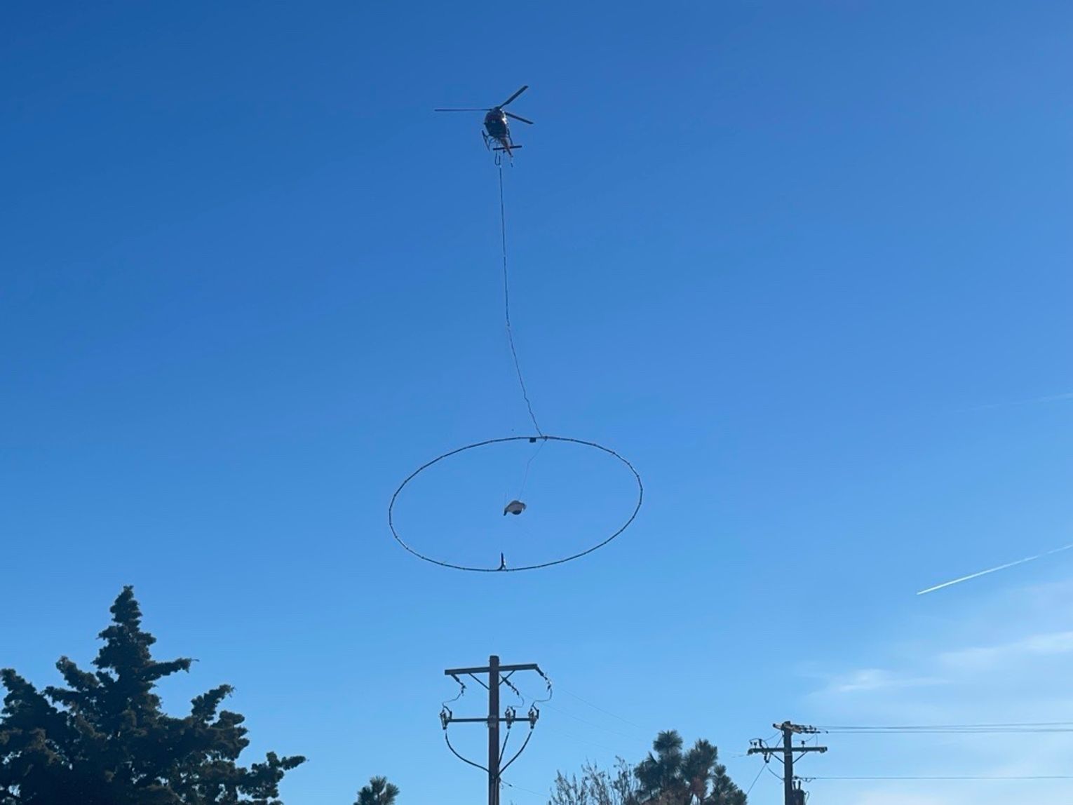
Residents of northern Nevada and eastern California may have noticed an unusual sight in the sky—a low-flying helicopter towing what looks like a giant lasso. Fear not; it's not an alien invasion, but rather the Earth MRI project in action.
In a collaborative effort between the USGS, the Association of American State Geologists, and various federal, state, and private sector organizations, Earth MRI aims to enhance our understanding of the geologic framework in the United States. The survey data, collected using a helicopter, will soar over parts of Mineral, Nye, and Esmeralda counties in Nevada, as well as Mono County in California. Weather permitting, this geological exploration is scheduled to kick off in mid-December 2022 and conclude by April 2023.
The focus of this local survey is to acquire modern high-resolution airborne electromagnetic data. The cutting-edge technology employed in this geophysical survey allows scientists to create high-resolution three-dimensional representations of geology, delving over 1000 feet below the Earth's surface. These 3D models and maps will be instrumental in understanding the distribution of critical mineral resources, energy reserves, and the potential for natural hazards.
The collected data will be made public, fostering collaboration between the USGS and scientists at the Nevada Bureau of Mines and Geology to guide detailed geologic mapping at local scales. As part of this initiative, a helicopter equipped with specialized instruments will traverse pre-planned flight paths at relatively low altitudes—100-200 feet above the surface.
The distinctive equipment towing beneath the helicopter resembles a large hula-hoop, functioning as a sensor to measure small electromagnetic signals, mapping geologic features beneath the Earth's surface. Flight line separation will vary, with about 3300 feet in detail survey areas or 3 miles in more regional survey areas. Xcalibur Multiphysics under Fugro Earthdata, Inc. has been contracted by the USGS to collect this invaluable data.
It's essential to note that the instruments aboard the aircraft pose no health risk to people or animals. Piloted by experienced aviators specially trained for low-level flying, the company works closely with the FAA to ensure the safety and compliance of these flights with U.S. law. Surveys will strictly occur during daylight hours, avoiding over-populated areas, and the helicopter will not directly overfly buildings at low altitudes.
So, if you spot a helicopter towing a peculiar apparatus overhead, rest assured that it's all part of an effort to uncover the mysteries beneath our feet, contributing to a deeper understanding of our region's geologic landscape.
Photo below by Rachel Dahl.


Comment
Comments